Walking through Pindos
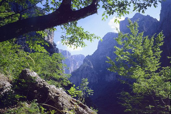
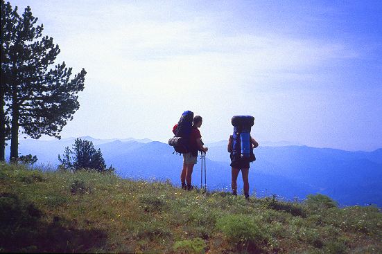
In the isolated Pindos mountains there are still some age-old villages, connected by foot paths. Between the deep mountain-sides are running Voidhomatis and Aoos rivers. In the Vikos-Aoos National Park and over the Smolikas mountains we wandered for about two weeks. We mostly did not meet anybody, sometimes a few excursionists.
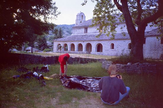
Till the next village, where we did ourselves well at delicious food and some hospitable sleep near the church....
Walking through Pindos
When the NKVB cancelled the "strange journey on foot through the Pindos" because of insufficient participants, we (those who had reported themselves) decided to make this journey on our own. Unfortunately Wim finally deserted because of family circumstances, so I, together with Bert, Eric and Karel took the airplane to Corfu, beginning of June 2000.
Then we took the boat directly to Igoumenitsa on the mainland, where we took the bus to Ioannina and by taxi to Monodendri.
It was a beautiful journey through a dense forest and a little populated area.
Sleeping near the church
The journey consisted of two parts: first through the National Park around the Vikos gorge and along the Gamila massive, a rest-day in Tsepelovo and after that, over the Smolikas massive. As we had much food with us, we left some at the hotel-restaurant Gouris in Tsepelovo.
Monodendri seems to have a nice old village center. In this area voyagers can sleep near the church.
But in Monodendri, the last hikers have made ruins there, so that only after the intersection of a waitress did we get the permissions from the pastor.
I think that after ten years nowhere we can sleep near the church.
Beneath it is cool
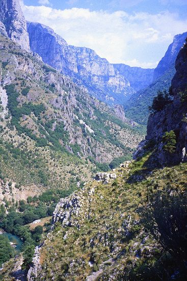
The first day of hiking begins with a pithy descent in the Vikos gorge. A large board mentions that the gorge figures in the Guinness book of Records: it is the narrowest canyon in the world (the walls are 900 m the one from the other and is 1100 m deep).
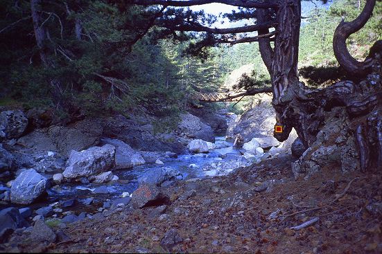
We follow over the valley the dry river-bed between the high rising walls.
There below, under the trees, it is nice cool. Half-way there is a side branch, where some water runs through the bed. Near the Voidhomatis sources a large water stream gushes out of the bank and the river runs again. There we place our tent on a meadow, which burns in the heat of the sun.
The path to Vassiliko is repaired by some Albanian workers whom we do not envy. Later on that day we are sitting between the "wild" horses and cows, very romantic.
Protected village view
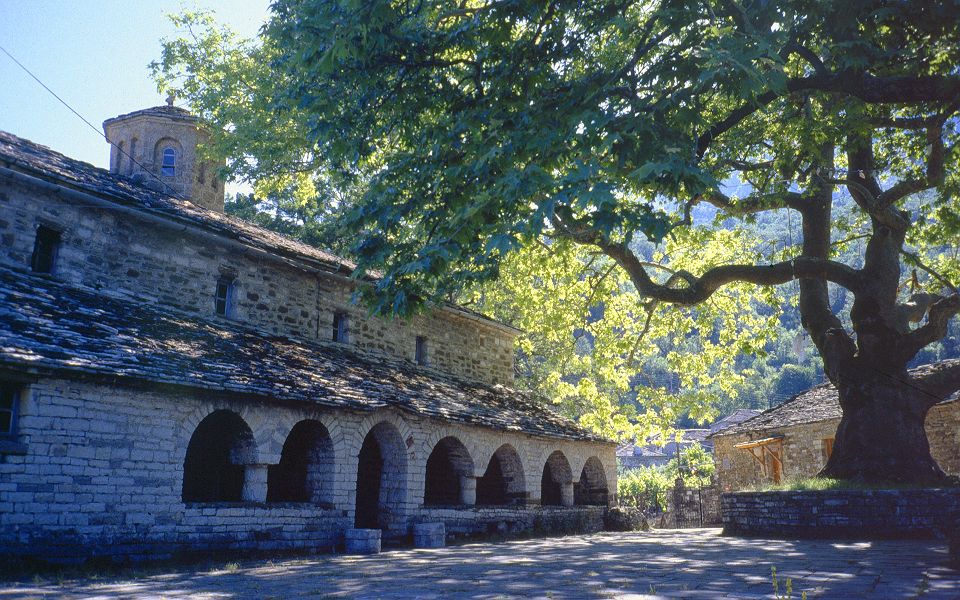
The next day we get up early because of the heat at noon, and walk on high to Mikro Papingo. This is a protected village view, where still some old women stroll about in black clothes. Most of the houses are used as holiday-resorts by Greeks from the big towns.
Near the church are, of course, age-old plane trees and we have a splendid view.
After a nice lunch at the local hotel restaurant, we go swimming in the swimming pool, a deep river near Kolymvitirio.
Many excursionists are in and around the Vikos gorge already. But we sleep in the verandah near the church.
We are going high.
Then we are going 1000 m on high to the Astraka pass.
It is a varied journey through a nice field: first in the shadow through dense birch wood, then bushes and even more open field and at last alpine meadow.
A large view at the surrounded chain of mountains. We 're followed by a Greek couple, the man continuously speaks and the woman jogges with difficulty behind.
The next two days we meet again, very tired. The Astraka cottage is situated on col (1980 m) under steep mountain sides, which remind me of the Dolomieten.
We enjoy a nourishing soup, but the sky doesn't look so nice. Just after the waitress has assured us that there will not be a thunder storm, the first lightning struck on the rocks on the opposite side, with a crackle blow; during one hour it was followed by many others.
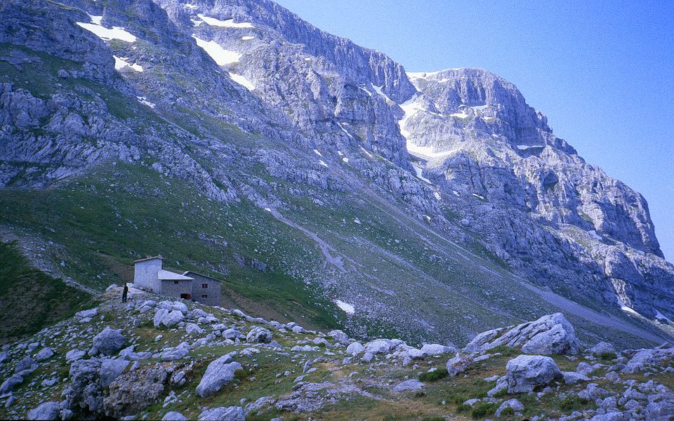
We decided not to camp at the top near the Drakholimni, but near a small lake 150 m below the cottage.
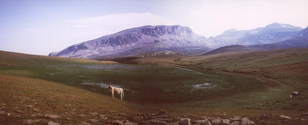
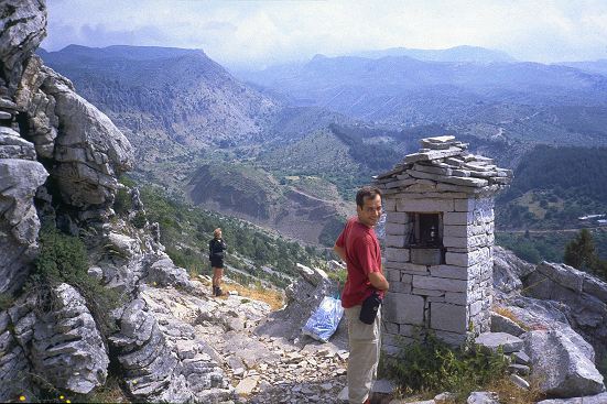
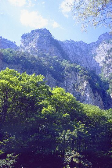
The weather looks up later, we are going as yet to the Drakholimni with a splendid view at the Smolikas massive (first photo area information) and the Aoos river in the fascinating steep depth.
Barking dogs.
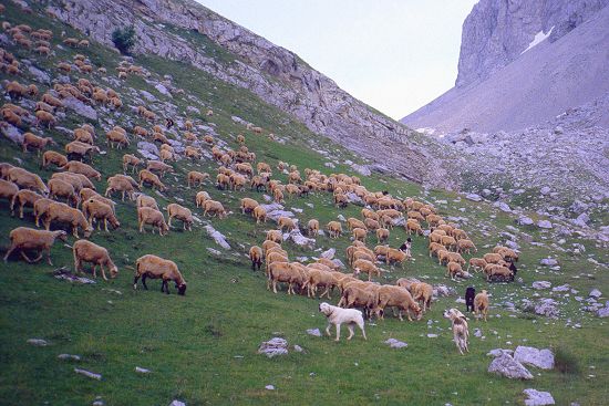
In the evening we make acquaintance with the well known Pindos-sheep dogs. These animals do not mess around with sheep, but concentrate themselves to walkers and other strange people, which they reach wild barking. Happily we find out that you can keep them at a distance by picking up a stone. We are curious to know if they can fight against the wolves, which people say they are frequent in the neighborhood.
We are preparing a soup.
Wide views
The next day we are going over a wide plateau, with a gap with rock-plateau every now and then (1 photo area information). We descend the ravine of the Megas Lakkos in which we are looking a little time for our correct rise to the col. On the top we lunch again with the well-known wide view, only Tsepelovo is just after a lower mountain top. We arrive at the hotel Gouris under rain, and we take a nice shower and we amuse ourselves at the restaurant. Alexis Gouris is dead, his wife arranges everything with the help of her daughters, who are speaking the English. They have information, that the bridge over the Aoos river, which we have to pass during the second stage, is still not repaired, but that the water-level makes possible to cross the river.
Historical excursion
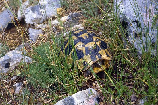
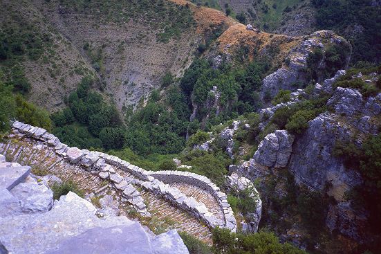
On our rest-day we see first a big land tortoise. We hike high around a canyon with splendid rock-formation. Then we come through Vhradeto della Mare (a ghost-town with rennovated center, with 1340 m the highest village in Zagori) near the old Kalderimi, a steep winded path with flight of stairs, which reminds us the Chinese Wall.
The two old arched bridges (one since 1764 and an older one which has been replaced in 1804) and a view of the Agia Paraskevi monastery (since 1617, nicely situated and with a beautiful entrance) end of our hike. A small bus brings us to a fording place in the Aoos River.
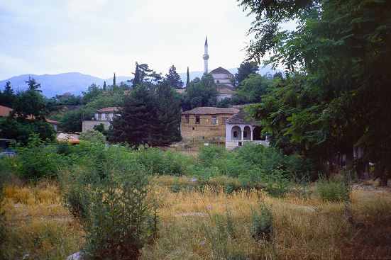
The half hardened road at the opposite swings on high to Paleoselli and we have a nice view at the Gamila massive of the first part of the journey. In Paleoselli we have found again an ideal camping place behind the church, ...till that BENG BENG. It is evident that we are just under the church-bell. Happily it does not work during the night, so we were sleeping well.
Dhrakolimni
The route to Smolikas top is beautiful, but above the 1300 the markings disappear. As we went up over the mountain shoulder we succeeded to go through natural wood and alps meadow (3 photo area information). We are camping 600 m below the top near the second Dhrakolimni. The history says that these lakes are created by a big dragon which appeared in the mountains. There we meet a German biologist who studies trees in Greece. He warns us about wandering Albanians, who have nothing to lose. We have not seen them.
Smolikas
From the Dhrakolimni the route is further marked with heavy zinc piles with precedence plates on them. We suspect that this expensive procedure is financed by an EEC subsidy. The next day we find ourselves one of the highest points in Greece, Smolikas, 2637 m. The mountain which we follow doesn't look so agreable. There are some steep snow fields to cross. On one snow field we see foot marks of bears (there are also polar bears?)
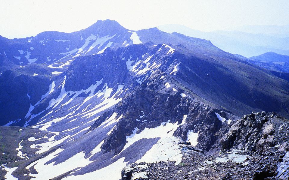
The descent to Samarina is long, finally with many loose round stones on the path, therefore heavy. Samarina has a large dull new quarter of houses. We have a nice conversation with the priest near the church. If we "are clean", we are allowed to sleep near the gallery. The interior of the church is beautiful, but the building needs a restoration.
Final troubles
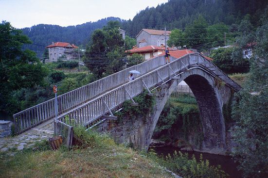
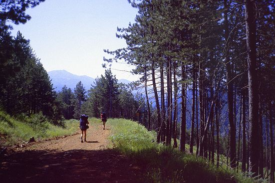
In the next stage follows the river and it is going first over a forest path. The second Agia Paraskevi monastery is closed. We descend to the river and we go on high about 500 m. A nice walk, but very heavy in the heat. And still it is only beginning of June. Obviously there is still some money of the EEC subsidy as we pass various wooden bridges which are not really necessary to cross the river. As we see Dhistrato in the distance, the path descends little by little, but changes afterwards, unfortunately, in a horrible ugly hard road. Dhistrato is a rather big village with good provisions (ice cream and cold beer). The last hike goes on a similar area as yesterday.
On the highest point the EEC route marking has at once disappeared. After searching, we meet the route on a lower level. As we arrive in the terminal point Vovoussa there is a soft rain. After a long negotiation in the village tavern-supermarket we took a bus to Ioannina and have still enough time to admire the stone arch-bridge.
Provincial way of driving
Our driver seems to have a style of his own. He actually creates the turning of roads, what is not hard to imagine on the endless mountain roads, but not on the provincial road. When we arrive in Ioannina, he does not want to drive on to the center. After a long conversation, there was a reason that his car does not cope with the car regulations (a VW bus since 1950). Happily we are near a camping, which is very nicely situated at the lake of Ioannina. Fine guests are two storks. The next day, the other people go back to Corfu, but I bivouac still one day at the lake and take a look at the historical old town of Ioannina, enclosed by walls (last photo area information). At Corfu the gentlemen have rent a nice apartment near "Gouvia beach", so that we enjoy some modern beaches. The town of Corfu is certainly worth while.
Pindos is a lengthy chain of mountains, which runs from north-west to south-east, north-west of Greece.
It forms a natural barrier between the district Epiros (west) and Macedonia and Thessalia (east). Ioannina is a central town, where the two large roads, to Konitsa-Albania and Macedonia or to Metsovo-Katarapas and the Meteora monasteries. The Pindos borders on Albania are in the north.
National Parks
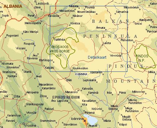
As shown in the general map there are two natural reservations in northern Pindos. Northern of Ioannina is the National Park Vikos-Aoos.
This is famous because of the spectacular Vikos gorge, one of the deepest in Europe. The Astraka, at the east, looks out this depth. On the other side begins the plateau which further goes up to the east till the knife-sharp milled edge of the Tymphi mountain, which is situated extremely high over the Aoos river. The highest top of the Tymphi mountain is Gamila (2497 m) with a splendid view over the Aoos and on the Smolikas (2637 m), the highest but one mountain in Greece (Olympus is 2917 m). Tymphi as well as Smolikas have a mountain-lake on their high plateaus, called Dhrakolimni.
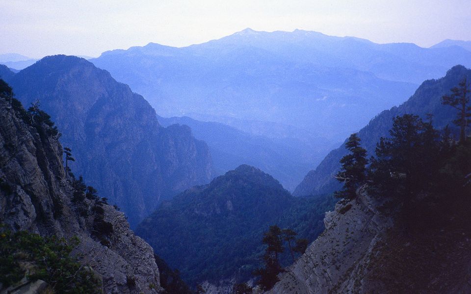
The second is the National Valia Kalda which is situated 30 km north-east of Ioannina. On both sides of this valley are peaks of more than 2100 m, as the Avgo.
There are many 1- or -2-day trips one can make in the Pindos National Park. The best hike goes from Vovoussa to the lake where the Aoos springs. This is the sequel of the same route we largely followed heading to Vovoussa: the first 4 hours you follow the E6, a European long distance trail. Then the route becomes steep for 3 hours, towards the Flegga Peak (2.127 m). The large lake, where the Aoos springs, is west of the peak, while east of it are two more beautiful lakes. For the descent route, there are 2 variants: a steep descent (2 hours) directly to the main road, or a descent over the ridge to the south (2,5 hours) to Metsovo, and then for 1 more hour on a paved mountain road to the main road. There you can take a taxi (if you have arranged this in advance).
Fauna - hikers - wanderers
In Epirus, in the woods, are found many wild boars (pigs), wild cats and hinds. Other big mammals are to be found only in the high mountains. There are wild goats, some bears are special in the Aoos ravine. Although they are officially protected, they are hunted illegally, so they are very shy. Wolves are found especially on the north-west, near the Albania frontiers. Also various kinds of snakes and the Greek land tortoise are found in the pricking bushes. Big birds of prey are the lammergeyers, eagles and hawks. On the mountain slopes one finds large woods and meadows, where still some 50.000 sheep are wandering in herds. Shepherds of the Vlach-and the Sarakatsani run here yet a semi-nomadic life. The big wild sheep dogs are less idyllic, but we did not have problems with them. Also people warn us about wandering Albanians, who do not have anything anymore and therefore they do not have anything to lose. At the Greek-Albanian frontiers there is the army, but practically it is quiet (only it is advised not to go alone).
Zagori - the villages
This is the part of the country where we have wandered about, between the Aoos gorge (north), Mitsikeli mountains (south) and the roads Ioannina-Metsovo and Ioannina-Karditsa. In this still isolated area many villages are connected with old donkey paths. During the winter many villages are cut off by snow from the outer world. Villages as Mikro Papingo and Tsepelovo have kept their own character, with houses from stones. Old arch-bridges from the Turkish period are among other found near Kipi and Vovoussa. Vovoussa is the only village near the Aoos river and also the only that is not closed by the snow during the winter. Vradheto is the highest situated village (1340 m) a typical summer residence of the shepherd-community.
The nearby situated village Beloi gives a very nice view at the Vikos gorge. During the winter it is almost deserted, the same as the other isolated villages. However tourism appears here more and more. Many Greeks form the town have their holiday house here. From Ioannina there is good, but not frequent, bus communications to all villages. In and around the Vikos gorge many excursionists appear, which results in many new restaurants and taverns in Monodendri and Megalo Papingo. Forest paths have become wide roads of asphalt. Megalo Papingo is probably the oldest village, already mentioned in Byzantine documents. Together with the nearby situated Mikro Papingo, it is a good starting place for journeys, with good boarding houses, which are a little expensive.
Ioannina
Ioannina is at the height of 480 m near the lake of Pamvotis, the largest fresh water lake at the foot of Mitsikeli mountains. Pindos is also water-parting, so that the voluminous downfall flows to the area near Ioannina to a large extent. The oldest part of Ioannina is the citadel with picturesque streets and old houses which are situated on a peninsula on the lake. It is understood that the history of these sophisticated places go back till 500 for Christ, but since 1020 they are in written papers. In 1453 the Turks lay hands on it (till 1913), many things still show it. There are many historical things worth seeing, as mosques and palaces, monasteries and fortifications from the Byzantine period. The archaeological museum is worth while. Around the citadel is a nice boulevard with shady plane trees along the lake.
Practical info
A good time to wander around is May or June. It is not too hot then (on the highest spots there are still snow fields) and you see most of the flowers. At noon it can be rather hot at 1000 m. It is difficult though to take a nap. We always started early in the morning, in order to arrive at a place of destination most often at the beginning of noon.
In most villages there is a restaurant where you can have lunch or dinner. Wherever we passed villages, we have made use of it, also to limit the quantity of food which we were taking with us. If you will march the whole route, you have to camp and to take with you a quantity of food (weight of backpack 16 till 22 kg). If you make use of hotels, boarding houses and mountain cottages you are limited to journeys of one till three days. There are also organized trips with transport of luggage, with which it is possible to make longer trips.
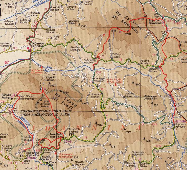
The green outline designates the National Forests
The places where we spent the nights are numbered
Walks diagram
On our rest days we hiked without heavy backpacks.
| Day | Place | Distance | Walking time |
| 1 |
Trip day: Amsterdam - Corfu (by plane) |
- | - |
| 2 |
Voidhomatis river (Vikos Gorge - 680 m) |
12 km | 5:00 |
| 3 | Micro Papingo (980m) Kolimvitirio (950 m) Micro Papingo (980m) |
5 km | 2:30 |
| 4 | Astraka (1.980 m) Ksirolϊtsa (lake - 1.800 m) Dhrakolimni (lake - 2.050 m) Ksirolitsa (lake - 1.800 m) |
10,5 km | 5:30 |
| 5 | Rombasi (lake - 1.950 m) Megas Lakkos (river - 1.500 m) (1.750 m) Tsepelovo (1.080 m) |
12,5 km | 4:45 |
| 6 | . Rest day: tour above rocks-gap Kalderimi (stairs 1.500 m) Vradheto de la Mare (1.340 m) Kalderimi ('steps') (1.100 m) Agias Paraskevis closter (1.400 m) Tsepelovo (1.080 m) |
15 km | 4:45 |
| 7 | with a car to the crossing place Aoos river (650 m) Paleoselli (1.150 m) |
4 km | 2:00 |
| 8 | Dhrakolimni (lake - 2.150 m) | 6,5 km | 4:00 |
| 9 | Smolikas (2.637 m) Lemos pass (2.450 m) along the bottom of the Bogdhani top Samarina (1.400 m) |
12 km | 6:00 |
| 10 | Agias Paraskevis closter (1.200 m) tributary river of the Aoos (900 m) via shoulder of the Gomara (1.600 m) Dhistrato (1.000 m) |
11 km | 5:00 |
| 11 | mountain shoulder (1.500 m) Vovousa (1.000 m) by bus to Ioannina camping |
14,5 km | 5:00 |
| 12 | Restday: (to take a view of Ioannina) Ioannina camping |
nvt | - |
| 13 | Trip day: by bus to Igoumenitsa by boat to Corfu Appartment Gouvia (Corfu) |
- | - |
| 14 | Rest day: to take a view of the town of Corfu Appartment Gouvia (Corfu) |
- | - |
| average per day (average height 1300 m - 10 walking days) | 10,2 km | 4:30 |


The writer of 'Walking through Pindos' is Jaap van der Veen.
The translation from Dutch to English was made by Kees Boogert.