Μετάφραση από τα Ολλανδικά: Kees Boogert.
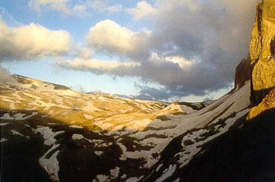
Hiking in the country of the wild dogs.
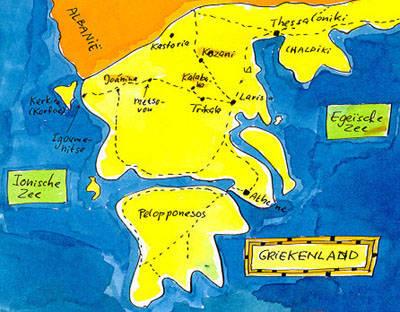
The mountains of Pindos in central Greece (Kakarditsa - Gamila - Timfi) May 1995 Near the Greek mountains Greek mountains are for me an unknown field. M. was also curious, so we decided to go to Pindos, in the center of Greece, in May. I had no computer then at home, no Internet, so I could not prepare myself through the pages of a Greek site. The site is called Oreivatein, which seems to mean "climbing in Greece". Of course, finally, I've consulted many hiking guides in the literature list. A few days before our departure we read in the newspaper that there are earthquakes in the center of Greece and that the inhabitants of whole villages live in tents. In the area of Kozani the earthquake was measured to be 6.6 of the Richter scale. This didn't stop us from going there.
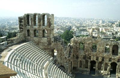
Ancient Athens
First we flew to Athens and stayed there for a few days, wandering around. We only made one mistake: we did not look for maps of our hiking area, and we have not been able to find them in Holland either. When we arrived later in Pindos, we didn't find any as well - we've been told that we should have bought them in Athens.
Trembling earth
From Athens we flew in a local plane to the northern town of Kozani. After a first view, there was not much to see from the earthquake's results. Since it was already late, we decided to spend the night here and found a damaged hotel in the center of the town. Later on, we saw that the hotel must really have suffered - among other things, the water pipes were damaged, so we had no water in the room. This meant that we felt like camping. When we went to bed, we felt vibrations. There are continuously light earthquakes.
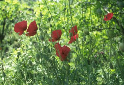
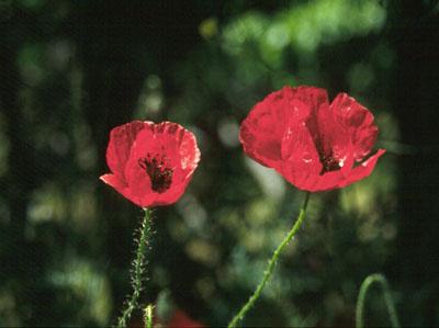
The next day we took the bus to Grevena. In the bus we met a Greek woman, who told us about the earthquakes in English. Her parents were living in Grevena, but she were not at home during the earthquake. She lived in Thessaloniki and travelled to see on what condition her house was. Grevena suffered most of the damages and at that moment, she said, most of the inhabitants were living in tents, under the fear of a new earthquake. The prediction was that the earthquakes in the Kozani area would continue at least for 2 more months. In Grevena we had to wait for a few hours for the bus to Kalambaka, capital of the Meteora area.
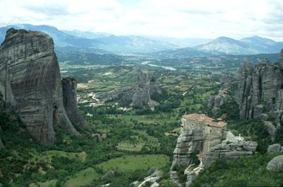
Monasteries on places difficult to reach: Meteora
Meteora is an area which consists of conglomerates of rocks; it is famous for the monasteries which are situated on all kinds of eagle-like "nests". In the past, these monasteries were only approachable through small foot-paths and rope ladders. May times the monks were drawn up by hoisting apparatuses. Because of the art treasures and the atmosphere, the monasteries are worth visiting; monks, though, are hard to see. There are monasteries as well as convents. Take into consideration the flood of tourists.
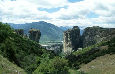
The monasteries are not always open. If you wish to have a look, it is recommended to check with your travel office or with your guide, about the opening hours. We have hired motorcycles and thus we have visited all of the monasteries. The landscape is very impressive.
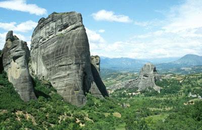
Meteora is also a climbing site with all kinds of paths.
Meteora further offers possibilities to hike, but the paths are not always very easy to find. There are no marked paths in Meteora.
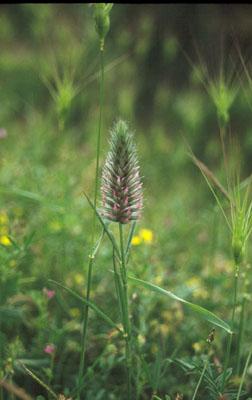
Description of a hike.
We have walked from Kalambaka to the north-east, where we found a footpath that brought us to the abandoned monastery of Agia Triada. After visiting the monastery, we walked along the asphalted road to the west and then descended through the prick bushes, searching for the foot-path, which would lead us to Kastraki. With some difficulty we found that path and came at last in the village Kastraki, north-west of Kalambaka. After a drink in the village we walked along the asphalted road in the direction of Kalambaka and at a certain moment we went lefty into the valley. According to our map, it is possible, through that path, to reach a pass to the east. Right in front of the pass there is a chapel, after that a footpath down to Kalambaka. It starts smoothly, but at a certain point it becomes sliding and not secure. One walks tensely, for me it was not relaxing - happily we descended well.
To the interior: from Kalambaka to Milia
It is time now to go to the mountains. Our plan is to travel to the Kakarditsa massive and there to start hiking. Kakarditsa is a mountain, south-west of Kalambaka, 2.469 m. high. This area consists of limestone and, in a number of spots, one must take into consideration a big crumble. According to Dubin, our hiking guide, it is possible make a cross over the pass near Kakarditsa top.
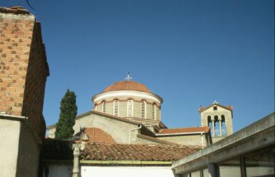
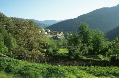
It seems that no bus is going to the right, so we make inquiries about the cost of the trip by taxi. The price is good, so we arrange with the driver when to start. On the way, we have selected the village of Politia, because there we would be able to eat to a tavern. We travelled in the heat of the taxi the weather was very hot and sunny - through a rough landscape. In the beginning we travelled on asphalted road, but a at certain moment the asphalt disappears and we went on all kinds of sandy roads, on our way to the interior. It is striking that still many villages are situated near those sandy roads. Before straightening out those roads, the villages were secluded from the world. The taxi driver set us down in Politia, the weather was still very hot, and asked us if we wished to have his telephone number, in case we needed a taxi to return. Politia is deserted and he probably asked himself "what are those two strangers going to do in this village"?
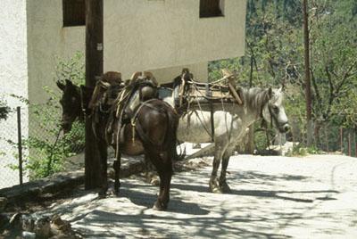
In the heat, we carried on high in the village and found out that the tavern was closed. A few people were sitting in front of it, but the communication was quite hard, since nobody spoke a language that we knew. The village gives an impression of loneliness. Happily, we met a man who spoke German. He worked in Germany and was visiting his family here. The owner of the tavern was going to town, we learned, but he might return tonight or tomorrow. Only a few families are living permanently here. The rest of the houses are occupied by Athenians who escape from the smog of the town during the months of June and July. He also told us that the village at the opposite side, Milia, has also a tavern, which is open.
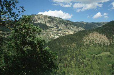
Moreover, in that village there is a pub with a small shop; our Greek friend offered to bring us there. We accepted the offer, since we were thirsty and hungry. Our friend talked to a Greek, who had a small bus. Under the hot sun, the bus jog-trotted on the sand-road, down and then up again, to Milia.
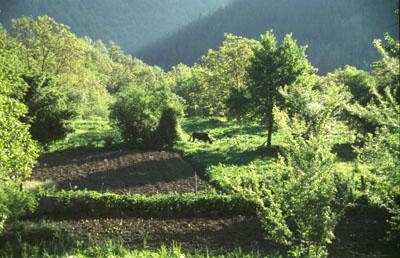
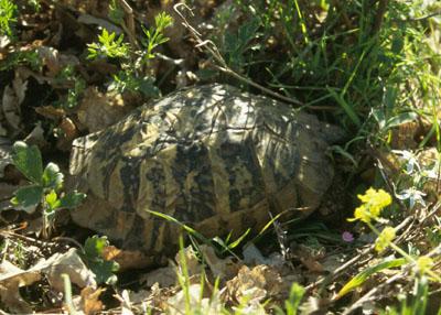
Milia seems to be very agreeable, it is an agricultural village, no houses for tourists (at least none attracted our attention). First we visited the pub with our two guides and had something to eat. Then we walked to the tavern and had arranged that we could spend the night. Then it was time for an afternoon hike. We walked high to a small chapel near the village and then through the oak-forest, which is situated above the village. There, we admired and photographed a tortoise!
Back to the village, the tavern served us a simple but nourishing dinner and next we had all the time to watch the happenings in the village, from our terrace. Then, we made plans for the next day. We had a Kakarditsa map from Oreivatein. Politia is just opposite Milia.
On goat-paths to a holiday resort: Hiking from Milia to Politia and back.
The plans for today include a walk to the opposite side. Considering the view from Milia, the walk through the forest, with the view of the mountains at the opposite side, should be wonderful.
We made an effort to explain our plans to the inn-keeper, who gave us extensive answers. I'm afraid we both missed languages... But with or without his advises, we enjoyed this day.
Description of the hike.
From Milia we walked down, on the sand road to the river. As far as we could see, there was no alternative road down. But that can also be an illusion. We passed the bridge over the river and then on the main road we went to the right. This is to the direction of Giurzia. This village is also called Agia Paraskevi on some maps. Near the next side-brook on the left, we took a side-path.
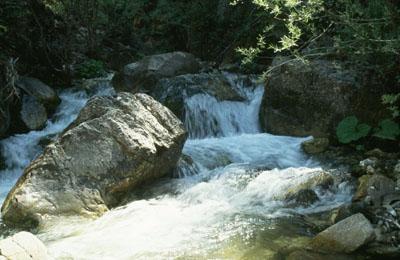
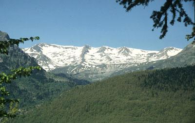
This path comes to a stop very soon. First we stopped by the river, which is very nice, the landscape was wonderful, but we didn't go on. At a certain moment we came to a dead-end and turned back. Suddenly, through the tree, I saw the beginning of a path going up. We followed it till the point where we crossed s wide sand road. From there we looked for a confirmation on the next hiking path. I thought I found something, but the path disappeared very soon. At hazard, we jogged uphill, what went OK. There, we got a view of the Kakarditsa massive at the opposite side. It is there we wished to go the next days.
Then we arrived to a higher sand road. We followed it in the direction of Politia and arrived some hours later. In Politia, the tavern was still closed. We met again with our Greek friend, who told us that a hiking path starts from Politia down to the main road. We did find a path, that ends in meadow-lands. Near the river, there are paths going down, which we can reach by climbing a gate. This way, we found the right way downhill. The path is very nice, along the river, near Politia. Then we passed the same bridge and walked to Milia from the main road.
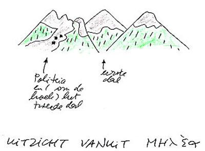
Here below is a sketch of our hiking, Milia-Politia, seen from Milia.
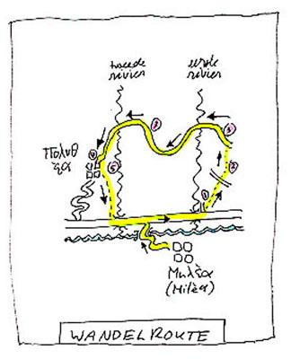
Explanation of the hiking route Milia
- 1. Along the side river path, that comes suddenly to a stop. At the beginning of this path there is a small road, difficult to see at first, going to the right, and clearly leading high to the a sand road.
- 2. Here we did not find a path, so we went uphill at hazard.
- 3. Further, we walked over a wide sand path. Less attractive to walk on, but the view was nice.
- 4. Right in front of the village Politia, the path was destroyed due to construction works. There were a few side-paths which perhaps are going uphill. But we had no time anymore.
- 5. This river has steep valleys, here and there, like gaps.
A heat-wave in Kakarditsa: from Milia to Giurzia and Gardiki and back
Today we are leaving Milia and set out over a hiking path from Milia in the direction of the villages of Giurzia and Gardiki. The path goes through an oak-forest and at a certain moment we see along the route a toad as big as 2-3 human hands!! I have never seen such a big toad and ...there it is!
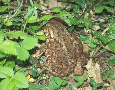
The toad disappeared quickly between the plants, but let itself seen for a moment. Unfortunately the paths disappears at a certain moment, as the slope becomes steeper and we come close to the main road (sand road) to Giurzia and Gardiki. Probably the footpath is damaged after the construction of the main road. After some climbing, we arrive to the main road and we continue our way in the heat-wave. We don't meet anybody there.
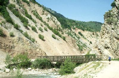
Giurzia gives the impression of a deserted place and according to the people we spoke to, there are no shops. We needed one desperately, since we wanted to get things for the next day. Our plans included crossing the Kakarditsa massive through a simple path (we hoped). Therefore, despite the heat, we kept walking to Gardiki. This village is very nicely placed at a slope, but seems evacuated, just like Politia.
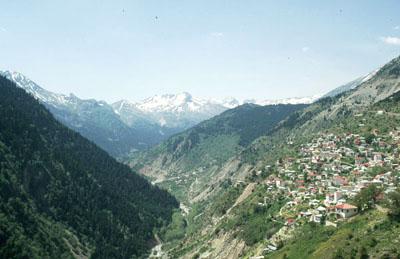
At the central square, we find a coffee-house and also a shop, where we can buy our things. It is still warm, so the coffee-house in the center of Gardiki is still closed. After a refreshment, we had to return to Giurzia, since it was there that the route to Kakarditsa started. The weather started to cool down and, to our disappointment, two cars going to Giurzia, had just left. That day there was no bus leaving anymore, so we had to walk there. On our way we met a motor-van, and the driver was willing to give us a ride.
So, we arrived to Giurzia. Followed by young Greek boys we walked through the village to an eventual camping ground in the Gorge. After a certain bridge, the boys returned, since their parents warned them that to this bridge there are hungry wolves! That place is very nice from our tents. We camped that night beyond the bridge, near the bed of the river. Under the afternoon sun, we pottered around and liked it very much.
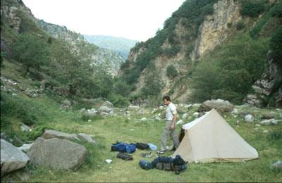
A dog's life for mountain-hikers. Surprise and sensation in the Greek mountains from Giurzia to Matsouki
Today is the big day for crossing the pass. We try to follow the rough indications of Dubin. Despite what he said, we didn't cross the river, but followed a path over a hill-top. Further on, it is possible, through a small bridge, to cross the side branch of the river and follow the left branch. At a certain moment we found ourselves on a sand path, which zigzagged slowly upwards. We didn’t understand where the path started. The sand path is certainly not a fascinating walk, although the view is nice, but it brought us very quickly to the vicinity of the pass. Moreover, we had the path to ourselves.
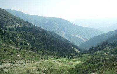
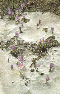
In the vicinity of the pass there are three shepherd cottages. The lowest one is far down below and the path goes upwards. The second is at a spot visible from where we are, but we also see that there is snow near the pass. The third cottage is further on along the sand road, we haven't arrived there yet. Everywhere we see crocuses growing from inside the melting snow.
Stone pillars show us the road to the pass. This is probably the pass also described by Dubin. On the way to the pass, we went around some snow fields and walked over stone-blocks, enjoying the nice view.
On the pass we see that the mountains at the other side are much steeper. The slope is vertical and there is also snow, here and there. If we look better, we see some paths zigzagging downwards, running through the grit. If I come to see that, I'll not be at ease. M thinks that we can do it, so I decide to toil and moil downwards. This means being extremely concentrated in descending to the sand way. The path goes through very fine grit and slipping would mean descending in a very painful way.
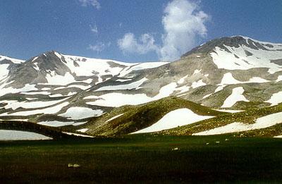
When we arrived to the sand way, we say pieces of stone on the road. On our right, a few cobbles of stones dropped downwards. The village Matsouki is far below.
In the meantime the sky went cloudy and it started raining. In the distance we could hear the rumbling of thunderstorms. During the rain, we found shelter in a shepherd cottage and considered further our planned route. Dubin promises that under the pass there is a path to Matsouki. Under this weather, we didn't think it advisable to search for the footpath to Matsouki and we decided to follow the sand path. This meant a good extra distance. Now and then a thunderstorm arrived but none was serious.
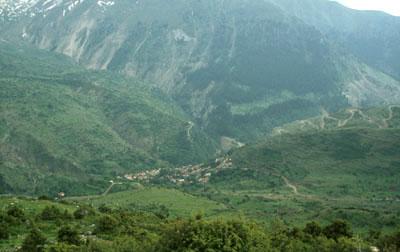
When we were near the village Matsouki, a herd of sheep crossed our way. We saw three dogs by the herd. If one of the three dogs discovered us, it would begin to bark and threaten us. This was alarming. Another dog followed and both made a hell of a noise - we turned around very slowly. We hardly dared continue to walk. At a certain moment, the shepherd started throwing stones to the dogs. The dogs got scared, but this doesn't mean they followed the shepherd, who started descending with the herd in the direction of Matsouki. Very carefully we continued walking and for another half hour we were followed by the two dogs, until they gave up and run out the other side.
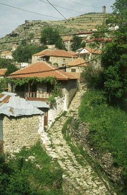
We saw that in the meantime all kinds of other herds went to Matsouki, also accompanied by wild dogs. We walked to a chapel, hoping we could hide ourselves from other dogs. Our plans to camp in the vicinity of Matsouki was destroyed with all those herds of sheep and undisciplined dogs. But how could we arrive to Matsouki anyhow, with all those dogs between us and the village? Our retrieval was brought by two young boys with motorcycles, who most probably took us for a couple of foreign girls wandering around. They came to us and we took the opportunity to ask them for a lift. We were allowed to ride the motorcycles, each with another boy. There was still an annoying shepherd dog following M and her companion. Just before the village the boys dropped us and so we walked the last part of the distance to Matsouki.
So we arrived in the village of Matsouki round 8 o'clock, exhausted and starving. Happily we were able to eat something in the coffee-house, Greek salad and bread. A boy indicated us a place, where we could pitch our tent. Pitching the tent I got panicked, because I thought, in my tired head, that we had lost the herrings!!
Back to residential areas: from Matsouki to loannina
Our enthusiasm over the dogs in Kakarditsa mountains is not enormous...Therefore we decided not to continue walking according to Dubin's instructions, but to take the bus in the direction of Tymfi and Gamila instead.
After we took this decision and found out that the first bus leaves at noon, we had the opportunity to walk around the village of Matsouki. It is an original shepherd-village, which is reachable by car only since a few years. We talked with a woman, who knew some German since she worked in Germany, and she offered a cup of coffee. Later in the morning we visited the coffee-house of her husband, where we had coffee again and he was astonished to learn that we make bread soup out of bread crusts.
We went in time at the beginning of the "main" road, a sand road where the turning point for the bus to Pramanda. The bus arrived there round 2 o'clock in the afternoon. The driver went out, wiped the sweat from his forehead, then searched for his diesel reserve tank. The diesel was then poured with a hose in the tank, with our assistance (especially M's). The driver sucked on the hose (bah, dirty diesel). Then the bus was ready to start and I have to say that I clasped my hands on the back during our trip to Pramanda. It is a horrible trip, with U-turns being as wide as the bus. If one looks down, one can see the abyss. The landscape is impressive, but the hiking path we wanted to take is not to be seen.
In Pramanda - a large village- we took the bus to Ioannina. The way of the bus goes among other villages through Agnanda and Monolitho. During the trip the view was nice, first we descended through slopes with forests and green villages. We passed Agnanda and then descended to a deep river valley. In the valley there was an old Roman bridge. Next, the bus was climbing over slopes dryer than in Agnanda and covered with prick bushes. These slopes are not irrigated by the rivers descending from the Kakarditsa massive. Finally, we arrived at Ioannina.
We had no wish to search for big hotels, so we entered the first we found on our way. We wandered around the town and went to sleep.
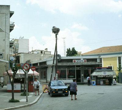
Arrival at the Timfi - Gamila area: from Ioannina to Monodendri
We are now at Ioannina, but how do we arrive at our target, the village Monodendri. According to the information office at the bus station, the bus left next day. We didn't like the idea and heard that an English-speaking couple asked the same question. We talked to the people and then decided to take both a taxi to Monodendri. This was possible seen the reasonable price.
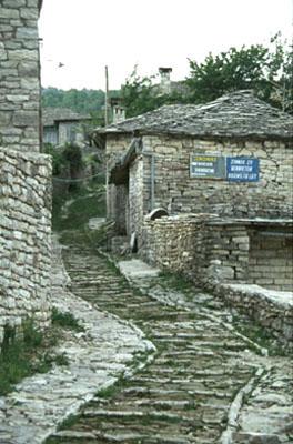
Monodendri is a very picturesque village, houses built with grey stone and tourism is well developed.
There are many more houses and establishments than was mentioned in the Dubin guide. During our trip in the village it started raining and thunder storming. We sheltered in an apartment under construction. This was the only serious thunderstorm we had during our Pindos trip. The boarding houses along the main road to Monodendri were all full. The Vikos boarding house had still vacancy and was better situated, in the center of the village. I went to bed very early that day and slept very deeply.
The next day - it was my birthday - we walked in Monodendri and also visited the abandoned monastery that is situated not far from the village. Far below was the famous Vikos gorge.
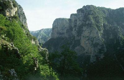
Through the famous Vikos Gorge, from Monodendri to Megalo Papingo
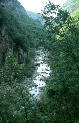
Today we followed the route through the Vikos Gorge. Opposite to what Dubin said, the marking of the route is fantastic. In the pictures below you can see a view of the river crossing the Vikos Gorge. In May there is still water, but during the summer it becomes completely dry.
The Gorge is classically nice, and there is still water in the river - I didn't pay attention at start, so my feet got wet. A little further we stopped a bit and took a swim. So I had the opportunity to dry my shoes.
On the way we met 2 big groups of Albanians. In Milia they had already warned us about Albanians. We don't know if what they said was true, we did not have any bad experience. I have learned that the men go to Greece to search for work. They use the routes through the mountains to avoid Greeks. The first group of Albanians even sends two scouts in advance. They look very poor with their cotton bags over their shoulders and walking in athletic shoes. And there are we, walking with our beautiful gear... Even when we left the Gorge, the route remained beautiful.
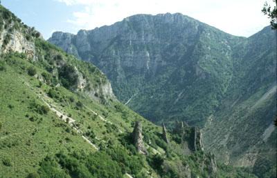
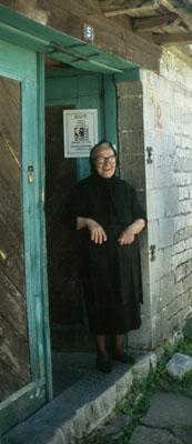
The weather is extraordinary. Our hiking ends in Megalo Papingo, where we find a place to spend the night - a grand-mother who owns a boarding house. She speaks mainly Greek, but yet we try to have a conversation with her. If I have understood well, she had six children, living allover Greece.
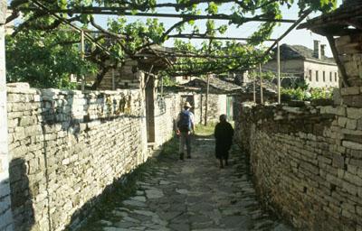
In the village we had information on the planned route, in the direction of Smolikas. According to our informant there is a lot of snow and nobody has walked yet from the Smolikas side to the Astraka cottage. Therefore we decided to give up the cross-through plan. We left our tent behind. So we were able to walk the next day to the Astraka cottage with little luggage.
Through the Vikos-Gorge a river is running, indicated on the map as Voidomatis. At the end of the Gorge lies the village Vikos, to the north one finds Megalo and Mikro Papingo. East of Mikro Papingo is the Astraka cottage.
From the notice boards below, it is evident that people ARE hiking on mountains in Megalo Papingo. However, it is not clear if a cross through the Aoos Gorge is possible.
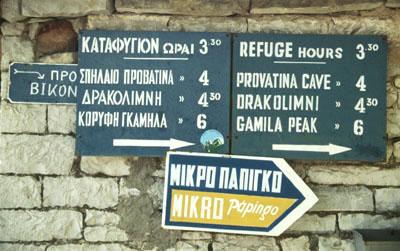
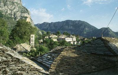
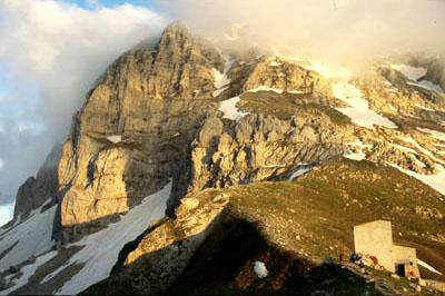
In the massive of Gamila and Timfi: from Megalo Papingo to the Astraka cottage
In the morning we haven't done many things. In the afternoon we started with dark weather from Megalo Papingo. To our disappointment we learned on our arrival that there was a Dutch invasion at the Astraka cottage! There was this group of four Dutchmen, who followed an individual route. We were a little bit jealous by the fact that the quartet had a better map with the general view of the Timfi - Gamila area than ours. We think that theirs is a well chosen route, in which all altitudes are mentioned. Sometimes it is an advantage to arrange trips through travel offices...
Further, there was a young Dutch couple who we also met in Monodendri and in Vikos Gorge. This means in total eight Dutchmen. Down near the lake, there was also a Dutch lady with her tent. We met her yesterday in the boarding house of the grand-mother. Finally, we found in the cottage the English couple, with whom we got a taxi to Monodendri.
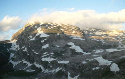
This afternoon the weather is dark, cold and windy, so to be outside is not very pleasant. We tried to order Greek salad as well as bread and spaghetti to the boss and his girlfriend, but only the salad reached is. In the evening we enjoyed ourselves playing the tin-game. We went to bed hungry.
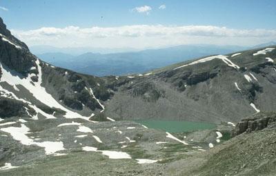
To Ploskos. Today the weather is very nice, the clouds have totally disappeared. We intend to climb one of the Gamila peaks. When we arrived to the top and studied the map better, we found out that we must be on Ploskos. Also from this mountain the view is very nice and we are sun burnt. The massives in the surroundings are well seen, the Kakarditsa massive, from where we came and the Smolikas mountains.
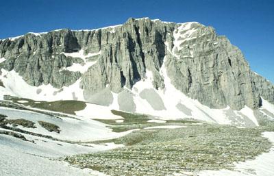
This was a classic mountain day - I enjoyed it. During the way back, we kept sliding and shouting on the snow downwards. The Dutchmen went away so we spent the evening alone with the 2 cottage managers and with a man from Konitsa, who spoke every well English and told us that he's been to Amsterdam.
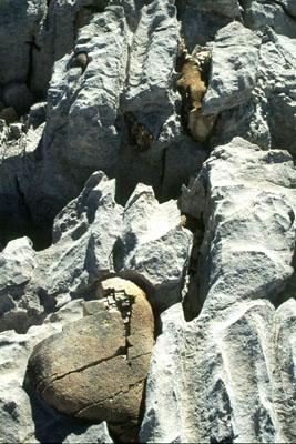
Here it is a real lime area. The red-brown stones between the lime consist of different elements (iron?).
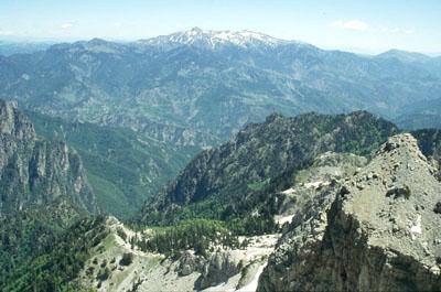
The most important mountain with a wonderful view is Smolikas, at the frontiers with Albania. Our original plan was to descend from here and then climb Smolikas. Because of the snow, unfortunately, this did not take place.
Hiking to Drakolimni Lake: back to Megalo Papingo
This morning we walked first along the nice path to the Lake Drakolimni. Near the lake we met the man from Konitsa, on one of the cottage manager's white horses. We stood with him on an outlook above the lake. Then we walked back to the Astraka cottage and then to Megalo Papingo.
In the village we met again the Dutch quartet and also the Dutch lady who travelled alone. We were able to provide her with information on the route through the Vikos Gorge. That evening we sat pleasantly at table in the local coffee-house. Then we had a look on how we will proceed the next day.
Through the brush-wood to Klidhonia: Megalo Papingo - Kato Klidhonia - Konitsa
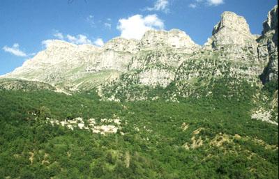
If one walks in the direction of Klidhonia, one finds a route with red markings. Probably this route is marked by a travel organization. To follow the red marks seems to be a good choice. During the way, we didn't meet, thanks God, any shepherd dogs. We did meet a shepherd with his herd. From this route one has a splendid view of the Astraka massive.
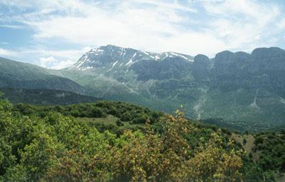
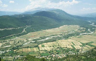
The route is nicer than I had expected and runs along splendid local small roads. On the way, there are many prick bushes. In the high village Klidhonia we found, after some search, the old road, inlaid with stones, which winds down the lower (Kato) Klidhonia. This old road is a very nice route, to all its parts.
Route information
For your information here is a sketch for those who wish to climb from Kato Klidhonia.
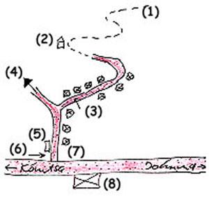
Explanation to the sketch
- (1) the old stone path, that winds down from Ano (upper) Klidhonia to the road below.
- (2) after that small chapel, the route is not very clear, the old road has disappeared.
- (3) asphalted road with houses.
- (4) sand road in Ano Klidhonia
- (5) public fountain
- (6) In the corner of the road there is a small plate, where one reads "Ano Klidhonia"
- (7) a clock (not working) on the other corner of the road
- (8) filling station
From Kato Klidhonia we wished to get a lift to the town Konitsa, planning to walk to the famous Aoos Gorge and to camp there. As it took us a long time (in the heat wave) to get a lift, we decided upon our arrival in Konitsa to look for a room in a boarding house. That done, we had a pleasant evening in a pub near the Gorge. We started talking with the couple that owned the pub; they knew English, since they had lived in Australia. Our conversation turned round the situation in Greece and we drank Retsina.
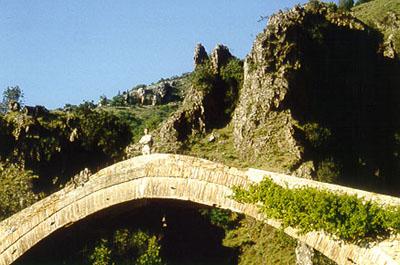
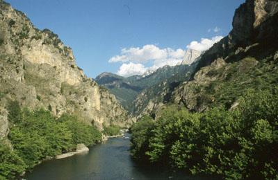
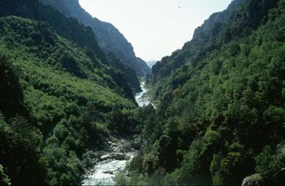
Konitsa / hiking through the Aoos-Gorge
Today we hiked the classic route to the Stomiu monastery in the Aoos Gorge. First, we took the small dull road downwards. Coming back, we followed the old footpath. The first part is still is use and offers a splendid view. The second part has unfortunately fallen into decay. In the beginning of the Gorge there is a notice board, where one reads that there are plans to mark entirely the hiking route to the lake Drakolimni. The progress of the work was not clear to us.
You can find a detailed map of the region if you click here.
Trip by bus to Corfu and back to Holland
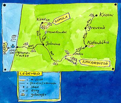
The end of our holidays approached. We started therefore from Konitsa and took the bus to Igoumenitsa, the coastal town opposite Corfu. From Igoumenitsa leaves the ferry to Corfu, where we boarded ourselves. We had the time to wander in Corfu, but the island disappointed us. The whole island is absorbed by tourists and the quiet country areas are hard to reach. We left Corfu and flew back to Schiphol, via Athens.
The Pindos mountains have been a captivating experience. With pleasure I would return once more, to see more of it.
Ellen Timmer, March 1999
Παρακάτω είναι δύο από τους χάρτες, που ζωγράφισε κατά το ταξίδι της: